Amherst’s Neighboring Towns: Shutesbury
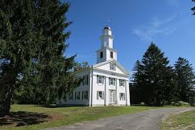
Shutesbury Community Church. Photo: Wikipedia
Amherst History Month by Month
by Hetty Startup.
Shutesbury is an architectural gem, especially its colonial era center reached via old country roads that climb to the town common on high, flat ground. Occupying the south-east corner of Franklin county, Shutesbury’s history is much older than its colonial past. For me, the area has a “lost domain” feel to it that is evident in maps. Bodies of water (especially the Quabbin Reservoir to its east) and forest predominate.
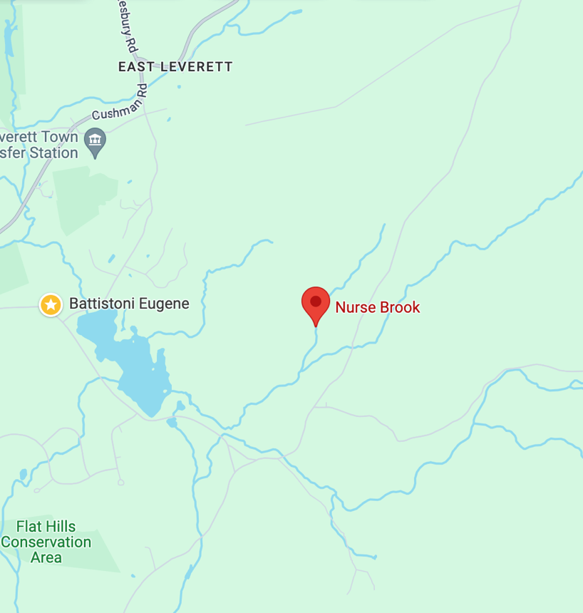
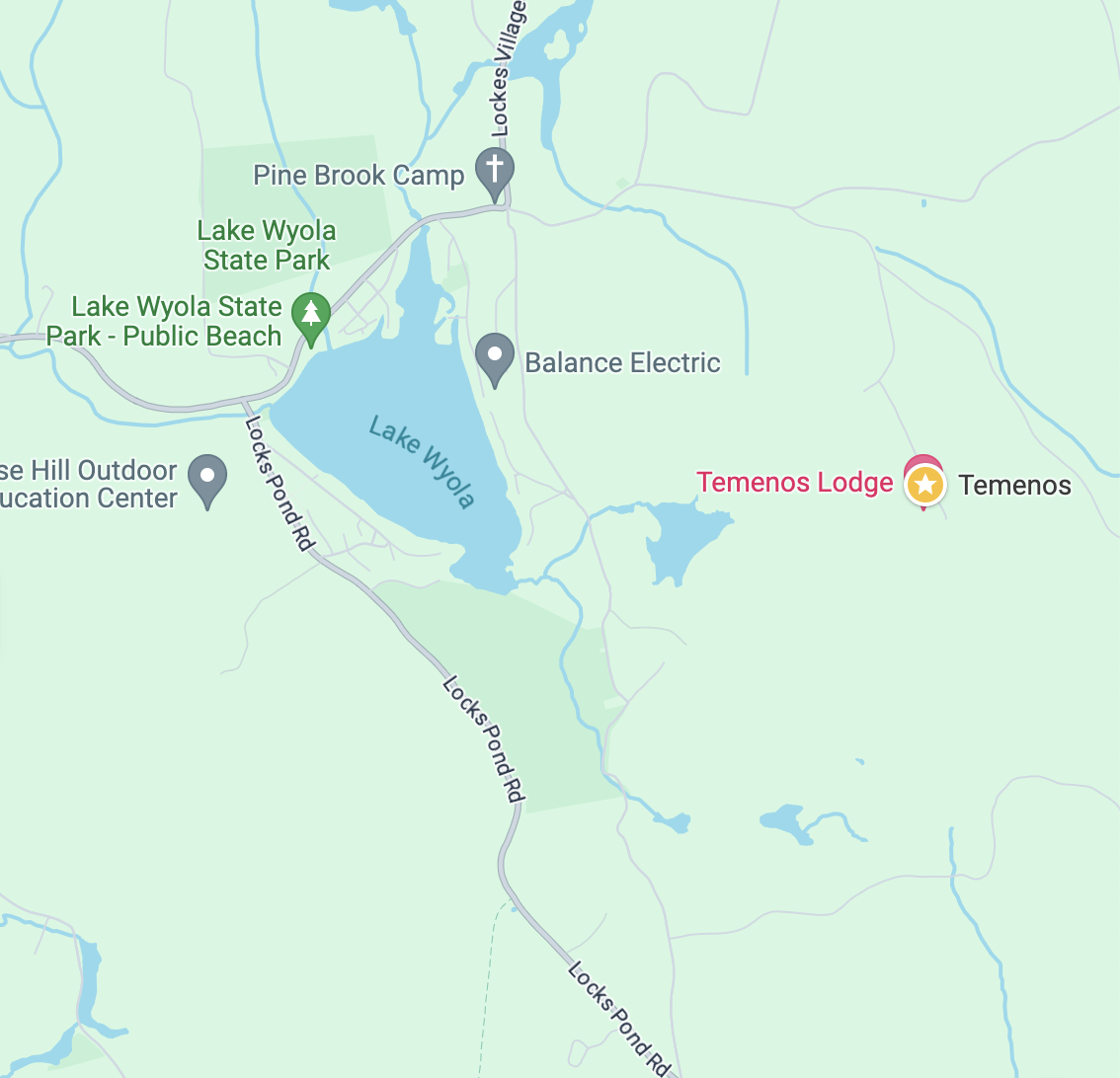
Two maps of different areas of Shutesbury are below.
In the 1730s, people back in Boston demanded that a road be built “in a roadless area” far west on lands owned by the English Crown in what was then part of New Hampshire and is now part of western Massachusetts. So Shutesbury was originally Roads Town or Road Town which must be the most boring name for a town ever! In 1761, Roads or Road Town was incorporated as Shutesbury, named after Governor Samuel Shute, a military man who saw active duty in the early 1700s in many campaigns. He was also a staunch royalist who became the fifth Governor of the Bay Colony and fought to maintain “royal prerogative” against an activist provincial assembly. He sounds like a disagreeable ‘gentleman’ with a contentious leadership style. He is also remembered for his poor diplomacy in communications with the Wabanaki peoples.
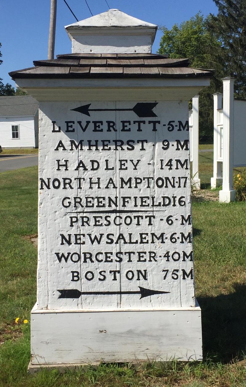
The town center has a distinctive meeting house that is now the Community Church (the congregation is now undertaking a new capital campaign, seeking funds to paint the church steeple and the peaks of the roofs and to make its bathrooms fully accessible. It is accepting donations to Shutesbury Community Church, P.O. Box 679, Shutesbury, 01072). This congregation, once affiliated with the Baptists, built itself a classic meeting house in 1827 and it still stands tall over the nearby town offices, the post office, the M. N. Spear Memorial Library (1902) and fire station. In 1911 church members merged with a Congregational denomination and in 2023, they re-dedicated the building, signaling a major comeback for many in the community. By the crossroads on the town common outside is a wonderful historic mile marker, that replicates the neo-classical style of the church.

Shutesbury today contains almost 700 acres of land that is part of Amherst’s watershed management plan. Much of this land, prior to colonial settlement, was deeply familiar to indigenous peoples like the Nipmuc and groups from the Wabanaki confederacy who traveled to and from these parts. The Indian Land Archive at Cornell University documents ownership patterns here in the period 1660 to about 1835 that show Shutesbury as a place “for hunting, fishing and collecting wild staples such as chestnuts, hopniss (Indian potato, Apios americana), blackberries, blueberries, service berries, sunflower root, and for cutting timber.
“The legal documents between the colonists and the native peoples related to land in Shutesbury specifically included a clause that deeds rights to sachems (chiefs) and their descendants stating “they, their descendants and assigns retain the right to hunt, fish and take wood from the lands they have thus deeded, and the English shall not prohibit them from taking wood and fish, and shall be friendly and neighborly toward them“.
In January 2021, the Shutesbury Historical Commission learned that the Wampanoag Tribe of Gay Head (Aquinnah) had reviewed some preliminary data about Shutesbury’s Pratt Corner neighborhood and “expressed an interest in conducting its own field research to determine if the site contains Traditional Cultural Properties.”
Colonial era and 19th century farmhouses and some later homes are evident in Shutesbury, but it is the landscape and the natural environment that predominate. Amherst’s Watershed Management Plan states that “Typical of rural New England, this [town] area… reverted to forestland following farm and field abandonment in the late 1800s. There are many stone walls, dirt roads, abandoned dirt tracks and wetlands in the town. Extensive blowdown of forested areas [also] occurred during the hurricane of 1938.”
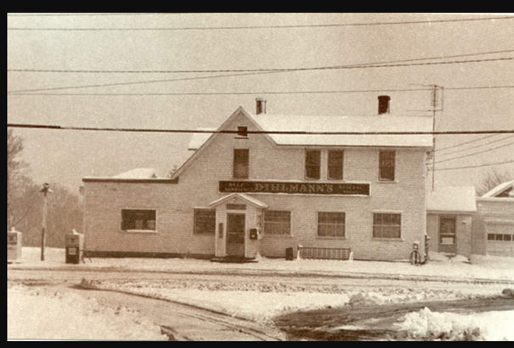
Reading descriptions like this is compelling for it suggests a relatively uninterrupted landscape of “forest cover [that] is regionally typical, with a predominance of white pine…red maple and other hardwoods…There is a fairly even representation of [tree] size classes, including large, medium, and small sawtimber and pole timber.” This language is so precise and clear, even a little old-fashioned, as if it should be read from a hand-written manuscript perhaps in beautifully penned copperplate. Even its one general store, the Dilhman Store, seen below in a photo from 1968, has been converted into the town’s post office. Unlike Leverett or Wendell or Montague, Shutesbury has been relatively unindustrialized although it is, of course, a town today that has obviously benefitted indirectly from industrialization.
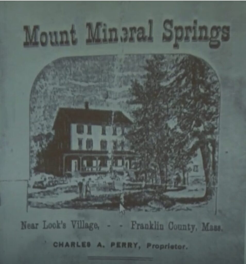
Another historic area combines natural features with more recent architectural history. This is the area known as Lock or Locks Village, not far from Lake Wyola and the retreat center known as Temenos nearby. Near this site, molybdenite crystal (and a metal alloy) was found, dating to the last Ice age. Mount Mineral Spring was incorporated in 1867 and at one time had its own proprietor managing visits to “take the waters.” In more contemporary times, the recreation area by Lake Wyola with its lakeside lodge and farmhouse, (1785) owned by the Department of Conservation and Recreation, and the Shutesbury Athletic Club on Wendell Road, offer other destinations for summer exploration.

To the east, Shutesbury is bordered by the Quabbin Reservoir, and due to its proximity to this huge body of water, sustains some of its rural character due to the restrictions placed on development within the watershed of the Quabbin. This does not mean the town cannot pursue new ventures–just last week town staff and citizens broke ground on its new Library Building, designed by Oudens Ello Architecture of Boston. Local reporter for the Daily Hampshire Gazette and the Amherst Bulletin, Scott Merzbach states “Oudens Ello has handled a number of net zero energy projects, maximizing roof space for solar panels.” I think it is safe to say that the town will enjoy much more in the way of cultural amenities than the road the British ordered for it in the early 1700s.
This column is the second of 10 in a series. Read the first column on Pelham here.
The series will include articles on the following:
1. Plainville, North & East Hadley and Hadley (center) are on Amherst’s border to the west (although do most of us know that Amherst was once a part of East Hadley?)
2. Sunderland (in Franklin county), Cushman, and Factory Hollow (important historic neighborhoods in North Amherst), the Pratt Corner neighborhood (and Shutesbury) and Leverett (Franklin County) are located to the north of Amherst. See also, https://www.amherstindy.org/2022/05/27/new-history-trail-to-be-built-along-the-mill-river/
3. The East Village of Amherst, parts of Shutesbury, Pelham (center) border Amherst to the east. West Pelham is where Abby Kelley lived), often comes up as a place name in geo-locations for weather and cell phone service.
4. South Amherst and the neighborhood of Dwight , Belchertown, Granby, Mill Valley (Amherst) and South Hadley are to the south of Amherst.
5. Hatfield and the neighborhood specifically of Bradstreet is also a border town to Amherst but the Connecticut River is the real border, perhaps a story all its very own.
The files of MACRIS maps [https://mhc-macris.net/] are great resources containing Form B listings of historic building in places like Pelham and Shutesbury and other towns across the Commonwealth. For short articles like these in the Indy, they are invaluable as they contain rich, detailed information (from deed research) about the generations of people who lived in these towns around Amherst over the centuries and the buildings or organizations they built and left for posterity. I encourage anyone interested to learn more about sites in these towns to take a closer look at https://mhc-macris.net/
Here is a better link to the Shutesbury forms https://mhc-macris.net/queryresults
The origins of Roadtown, as Shutesbury was originally known, are complex. For more information about what is known about Indigenous cultural traditions and history in Shutesbury, readers can read the 2021 Shutesbury Historical Commission report entitled “INTRODUCTION TO INDIGENOUS CULTURAL SITES IN SHUTESBURY, MASSACHUSETTS.” This report is available on the Historical Commission’s website at https://www.shutesbury.org/historical-commission. References and resources are cited in that report.
Thank you, Dr DeFant: I cite this report in this article. It was very helpful to me. I am sure other readers will appreciate your service on the Commission and take a closer look at this expansion of what we currently know. There is always more to learn.
In 2011 Shutesbury celebrated its 250th anniversary as a town. A number of finding aids were created at this time including this one from UMass which mention other significant histories in this town like the participation of about 40 of its denizens in Shays Rebellion 1786-1787 http://findingaids.library.umass.edu/ead/mums957
If you like maps and find them a useful source of information about the small towns around Amherst, Ward Maps is a good resource. You can zoom in on details from their site, link is here https://wardmaps.com/collections/atlas-of-franklin-county-massachusetts-1871/products/shutesbury-and-new-salem-massachusetts-1871