Amherst’s Neighboring Towns: Pelham (Part 2). “Upon an Eminence”

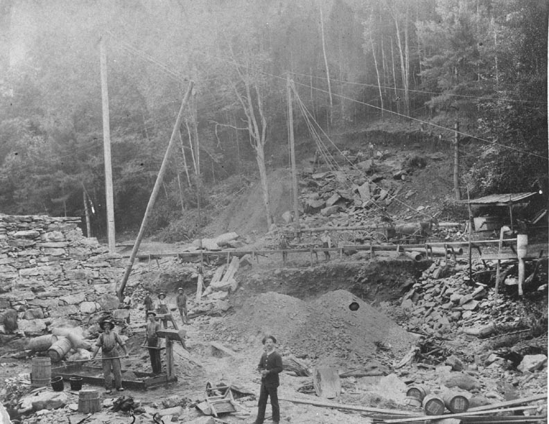
Building of the intake reservoir in Pelham in 1880. Italian stone masons were hired by the Amherst Water Company to build a dam on the Harris and Amethyst Brooks in Pelham. Photo: amherstma.gov
This column is the last in a 10-part series about towns surrounding Amherst. Previous columns explored Pelham, Shutesbury, Sunderland, Hadley, Belchertown, Granby, Leverett (Part 1), South Hadley, and Leverett (Part 2). For a listing of all previous “Amherst History Month by Month” columns, look here.
When I started this series, I began by looking at Pelham because of one particular house and the context of its residents over time. There was also a bit of a personal twist. As a result, that article offered few details about Pelham’s history so I am coming back for a second look.
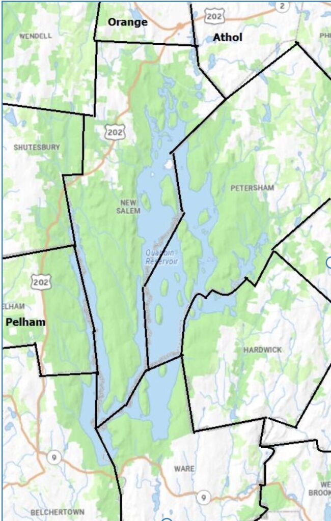
One of the most arresting views around Amherst is at the summit of the Pelham Hills, close to where Amherst Road (Route 116) ends and meets Route 202 (Daniel Shays Highway). This area is known as Pelham Hill. Perched on the western edge of the Quabbin Reservoir, which forms one of Pelham’s boundaries, this intersection is striking in its setting, architecture and historic significance. Since moving to western Massachusetts over a decade ago, it is a personal marker for being near home for me.
Below Pelham Hill, Amherst, with its East Village center, is to the west. While most of the significant architectural sites in Pelham date from the colonial era or later, and are closer to West Pelham, this spot is significant for demonstrating some of the other assets of the Commonwealth.

The Quabbin Reservoir is a relatively recent example of the state’s infrastructure (see also here). It was built in the late 1930s after the demolition, removal, and submersion of four towns (Dana, Greenwich, Enfield, and Prescott) in order to supply water to Boston and 40 other municipalities in eastern Massachusetts. This history lives on in the stories about families who lived by the Swift River, or who were impacted by the creation of the reservoir. It also continues to be a source of friction between our area and Greater Boston in terms of the allocation of resources.
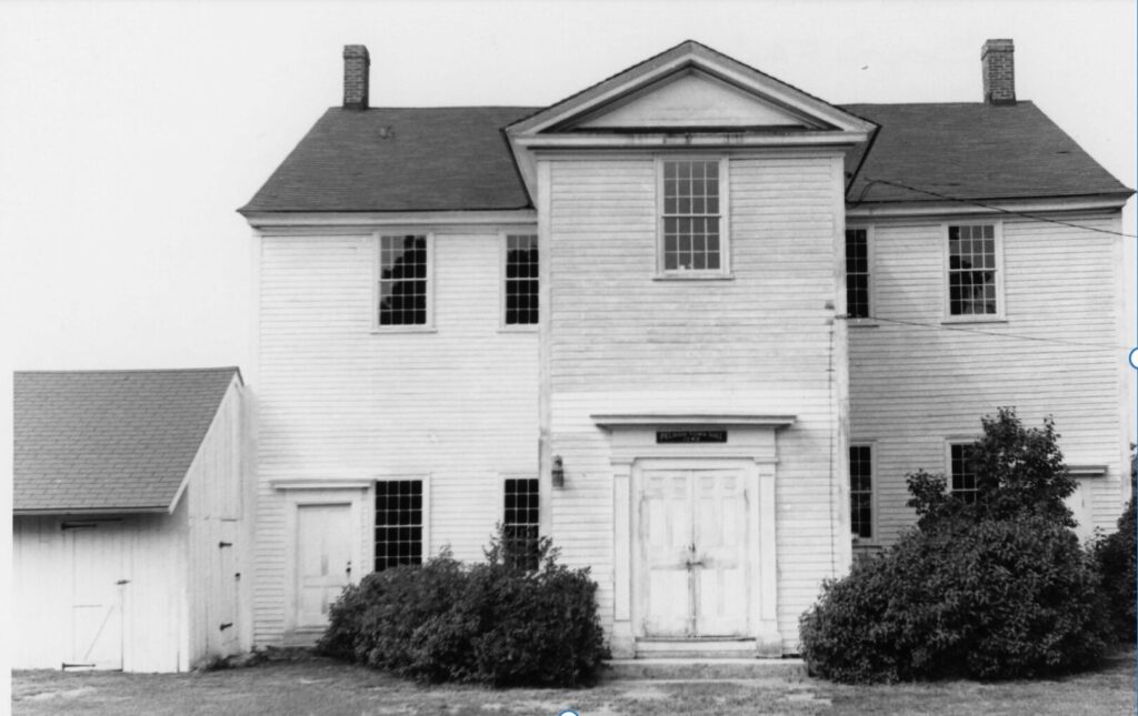
At this crossroad, there is also a burying ground laid out in 1739; a small church in the Greek Revival style, built about a century later; and Pelham Town Hall, apparently the oldest town hall building in continuous use in Massachusetts, built in 1743, the year the town was founded. After the state of Massachusetts adopted laws separating church and state in 1833, the new church building, now the home of the Pelham Historical Society, was constructed. Across the street is a handsome Greek Revival home from c. 1798 mostly associated with the Southworth family. Abiah Southworth married Kesiah Boltwood (1763-1835) who was the daughter of the Amherst tavern owner, Solomon Boltwood. One of their sons, Wells Southworth, drove a yoke of cattle with some of the loads of granite blocks from the Pelham hills to Amherst College for the construction of the foundation of South Dormitory. For a while, Wells ran a small store out of their home. Just north of this historic grouping of buildings is the Carl Edwin Stowell Building on Route 202 going towards Shutesbury and New Salem. This was also a general store for the area as well as the Rebel Cafe (in the 1970s and 1980s) and more recently the Bowen Studio.

Pelham Hill includes a monument, put up in the mid 1930s, to Daniel Shays (1747–1825). Shays, born in nearby Shutesbury, was a farmer who had fought at Bunker Hill. He was concerned about the impact of taxes imposed by Boston leaders on residents of Pelham and other rural Western Mass. towns as a result of the war. He and his band of rebels armed themselves and, without using force, successfully shut down local courts to the east in Worcester but also in Middlesex and Plymouth counties, and to the west in Berkshire county. The farmers were angry about the way debts were collected as there was a general lack of paper money to settle transactions. The reason Pelham has a marker is because it is thought to have been the site of Shay’s last encampment before the rebellion ultimately failed. The rebels’ convictions about taxes and economic hardship had some considerable influence at the Constitutional Convention of 1787 in Philadelphia.
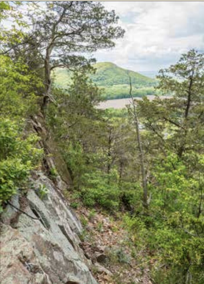
Another fascinating part of Pelham is the area known as Orient Springs, closer to the town line with Amherst and Amherst Road, which was known as the site of a popular 19th century resort. The hotel was dedicated in 1861, and geology professor and Amherst College President, Edward Hitchcock, was the main speaker. Written on the back of an advertising card for the site is this evocation: “No summer resort has so many attractions as the Orient Springs House. Besides the Mineral Springs connected with it, which the Professors of Amherst College have unanimously pronounced superior to all others on this continent for their curative effects; it commands the most enchanting views that the eye can rest upon. It is situated upon an eminence, and the view from the tower almost surpasses description. The splendid scenery of the broad valley of the Connecticut is spread out like a variegated carpet, surrounded by Mt. Holyoke and Tom in the south, Sugar Loaf and Toby in the west, while hills and mountains in the distance rise one above the other, making a scene of surpassing beauty and grandeur; while near reposes Amherst, a beautiful village with its rows of College buildings on elevated ground, surrounded by pleasant walks and shady groves.”

A similar view of Amherst and its environs is still possible – and still stunning from Arnold Road, and just over the border with Belchertown on South Gulf Road.

Pelham happens to be the site of the Town of Amherst’s Centennial Water Treatment Facility. The facility was chartered in April, 1880, when the Amherst Water Company hired stone masons to build out the gravity system near the Amethyst and Harris Brooks.
The Town of Amherst website describes how this parcel of land holding critical infrastructure was purchased in 1941. It is hoped that the brand new, state-of-the art facility, completed in 2024, will continue to bring high quality water to the Town for decades to come.
This series has been helpful to me – and I hope to Indy readers – in situating Amherst in a wider historical context. What the exercise has made most clear is that the borders of neighboring towns are really rather artificial and that both older and newer histories become evident once these colonial mapping elements are set to one side. The landscapes, settings, peoples, and buildings all contribute to more contemporary narratives, ones that are both more inclusive and more specific about our place in the world

The ‘Lost New England’ page on Facebook currently has a post about Pelman, MA (it is the twelth down in the feed currently [https://www.facebook.com/lostnewengland] offering more anecdotal history of the town, including a story of an infamous pastor. The first post is an interesting reflection on the whole trend of ‘then and now’ type photography. Relevant when thinking about historic preservation.